Find data
Syracuse Community Geography maintains a repository of local GIS data that faculty members can use to support research projects.
For access to GIS databases, local maps and online mapping tools, visit the Maps, Data and Profiles page.
SCG is part of a growing movement of “community engaged scholarship”. Our community driven research projects are interdisciplinary and generate opportunities for scholarly research. We help to facilitate partnerships between university faculty members and the broader community to analyze local and regional concerns. SCG leverages the wealth of knowledge and talent of faculty and students, and puts them to work addressing such problems as economic development, public health inequality, food insecurity, neighborhood revitalization, government and social service provision inefficiencies, and environmental change.
We facilitate local research opportunities for faculty partners. SCG projects explore fascinating topics at the local scale – from hydrofracking to urban food access. Faculty interested in exploring local, community-based and participatory research ideas should contact us.
We assist faculty to design and implement course projects that support community-driven initiatives. Because this requires extensive planning, please contact us at least two months before the beginning of the semester.
We make guest presentations about our research projects and processes, and about using GIS in social science research. We also provide introductory workshops for faculty and their students using online mapping and Census data. To request an invited lecture or workshop, please contact us at least one month in advance.
Syracuse Community Geography maintains a repository of local GIS data that faculty members can use to support research projects.
For access to GIS databases, local maps and online mapping tools, visit the Maps, Data and Profiles page.
Share your data using the Maps, Data and Profiles page. Contributed datasets and maps will be used by community partners and others to undertake local research.
Contact us to learn more about contributing data.
Online Mapping
MapSyracuse is an interactive web-based mapping tool containing mapped data for Onondaga County, NY. MapSyracuse allows users to create, save and print customized maps.
GIS Resources
The GIS Resources page provides links to everything from journals to conferences.
GIS at SU
The Bird Library provides access to GIS software, data, ESRI trainings and more.

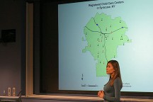
SCG partners with other university programs doing community engaged work. Professor Robinson has partnered with Carol Dwyer, Director of the Community Benchmarks Program in the Maxwell School’s Policy Studies program to undertake several research projects with community partners and students. Robinson has worked with students in Dwyer’s Community Benchmarks class (PAF 410) to examine access to public bus shelters, child care availability and community indicators for CNY Vitals.